Kyststien – trekking around Bornholm
Kyststien (The Coastal Path) is a classic multi-stage trail running approximately 120 km around the entire island of Bornholm along the coast. The route is divided into 7 stages – one stage per day – giving a week of hiking through the granite cliffs of the north, rocky east coast and sandy beaches of the south. The trail passes through over 30 harbours and coastal settlements, and for most of its length runs through wild nature with views of the Baltic. Optionally, you can return from any stage by BAT bus and complete the route at your own pace.
Trail facts
Length
Approx. 120 km – full loop around the island in 7 stages of 11–20 km
Completion time
7 days – one stage per day. At a more relaxed pace with rest days for sightseeing: 9–10 days
Surface
Varied: tarmac in towns, forest paths, gravel, beach, granite rock. The north is demanding, the south easy and flat
Waymarking
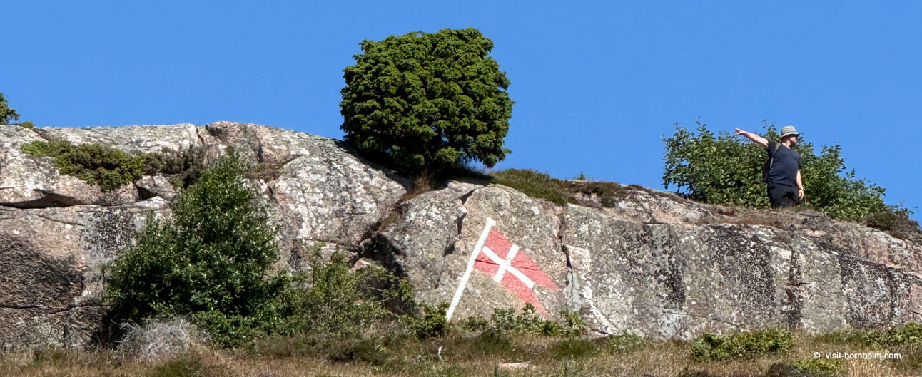
Orange signs with a white walker symbol. The trail is marked in both directions
Footwear and gear
Ankle-high trekking boots (granite can be slippery). Windbreaker, water, provisions. For the multi-day route: tent or accommodation bookings
Direction
Either way – the trail is marked in both directions. Most hikers start from Rønne clockwise
From rescue paths to hiking trail
Kyststien is not just a scenic route – it's also part of Bornholm's maritime heritage. Much of the trail follows former rescue paths (redningsstier) that in the 19th and 20th centuries served rescue crews for rapid access to the sea when ships ran aground on the rocky coastline. The paths connected rescue stations positioned around the island. Today they are quiet hiking trails – but they still tell the story of the strong bond between Bornholm's residents and the sea.

In 2021, Bornholm was recognised by German TREKKING magazine as Europe's second-best hiking region. Two years earlier, Condé Nast Traveler readers voted the island one of Europe's best holiday islands.
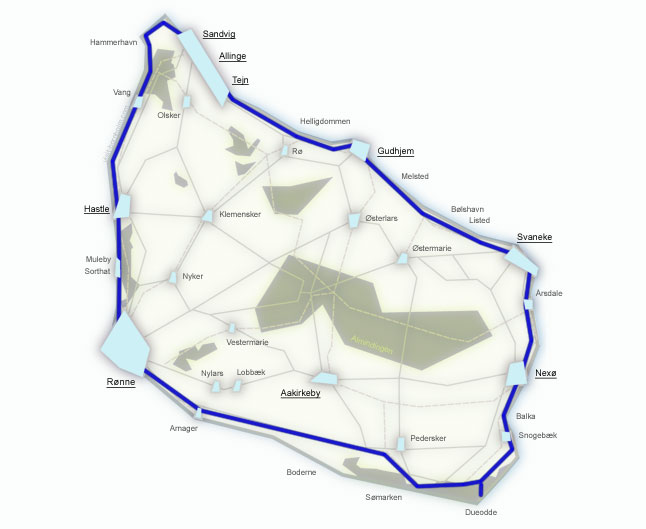
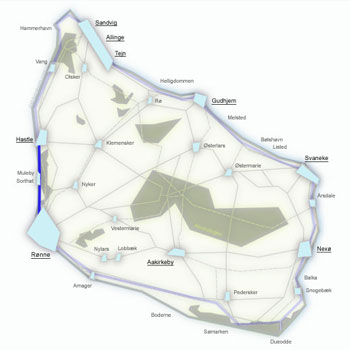
Kyststien – map of 7 stages
Multi-stage trail around the island. 7 days, 7 stages – from Rønne clockwise.
- ~120 km of waymarked trail
- 7 stages = 7 days of trekking
- Start and finish: Rønne
- Option to return by BAT bus
7 stages of Kyststien
Below is each stage – from Rønne clockwise. Start from Bornholm Velkomstcenter at Rønne harbour. Each stage works independently as a day hike – start and return by BAT bus.
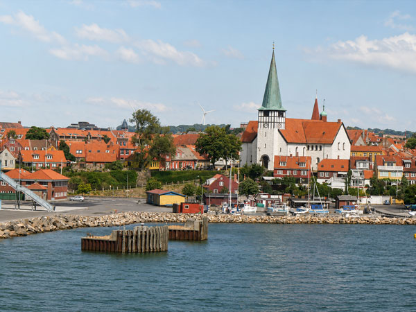
Starting point and finish line. The island's capital and ferry port. Bornholm Velkomstcenter at the quay – here you'll find maps, brochures and a printed Kyststien guide.
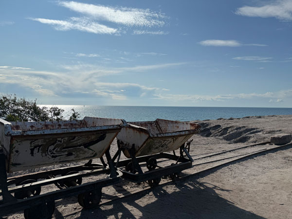
The easiest stage to start with. From Rønne north along Antoinette Strand beach, through Blykobbe plantation with forest paths, past Pyritsøen lake (former clay quarry) and the lunar landscape of Kultippen – a barren area left by a 19th-century coal mine with only old wagons remaining. Destination: the traditional Hasle Røgeri smokehouse – the last on the island where herring is smoked in open chimneys over alder wood.
Stage details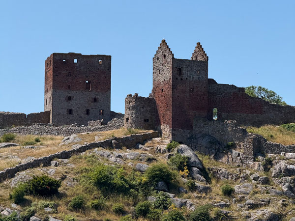
The most varied stage of the entire loop – uneven terrain with many ascents and descents, but rewarded with spectacular views. From Hasle along a paved path to the fishing villages of Helligpeder and Teglkås, then a steep climb into the forest to Jons Kapel – a legendary rock formation on the west coast. Then a narrow path high above the sea through Blåskinsdalen valley and Ringebakkebruddet quarry to coastal Vang. After a rest, a pebble beach and steep stairs to Slotslyngen, then through the forest to the ruins of Hammershus – Northern Europe's largest medieval fortress. Descent to Hammerhavn harbour and around Hammerknuden headland with its lighthouse and Salomons Kapel chapel.
Stage details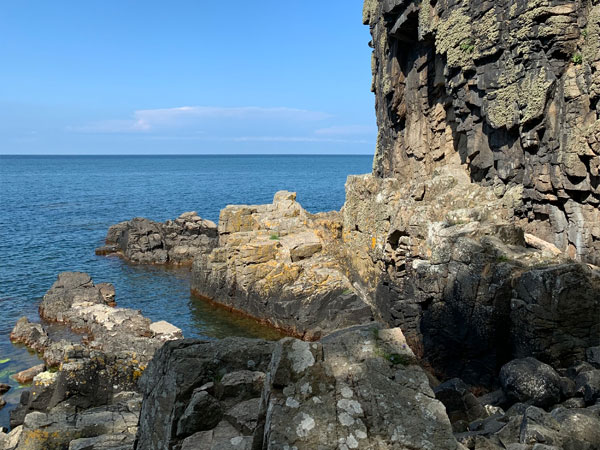
Dramatic cliffs and one of the island's most beautiful towns at the end. From Sandvig along Strandvejen to Allinge, past the harbour and then on a coastal path south through Sandkås and Tejn. Past Tejn the main road leads by Stammershalle Badehotel until the trail descends to the forest at Helligdomsklipperne – one of Denmark's most important natural monuments, with the Sorte Gryde cave and Bornholms Kunstmuseum art museum above the cliffs. The last 8 km is the most beautiful section of Kyststien: climbs and descents, idyllic fields, deep forest, a narrow path above the beach and views of Gudhjem from Salene Bugt.
Stage details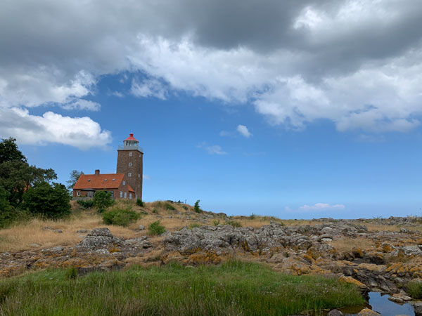
The east coast with half-timbered houses, small harbours and a rock phenomenon. From Gudhjem harbour up steps to the cliffs, then along a coastal path to Melsted and the Melstedgaard agricultural museum. Further south on a field road and forest path, past prehistoric menhirs, through Randkløve Skår – a 2-metre wide and 14-metre deep crevice in the granite cliff. Then idyllic villages: quiet Haralds Harbour, small Bølshavn and fishing village Listed. The last 2 km is a gravel path close to the sea with views of Vige harbour and marina, ending with steps down to Svaneke – Denmark's easternmost town.
Stage details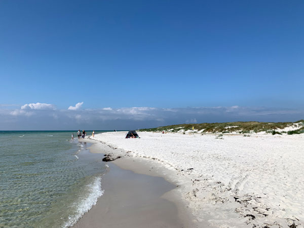
Transition from granite to sand – from the rocky east to the gentle south. From Svaneke harbour south past the old lighthouse and beach at Hullehavn Camping, then along low but dramatic cliffs above the sea. Through Årsdale with its distinctive windmill and smokehouse to Nexø – the island's second-largest town. From Nexø along a cycle path through Balka Lyng heathland to Balka Beach – one of Bornholm's most popular beaches with white sand – from where you walk the last 4 km directly to the fishing village of Snogebæk.
Stage details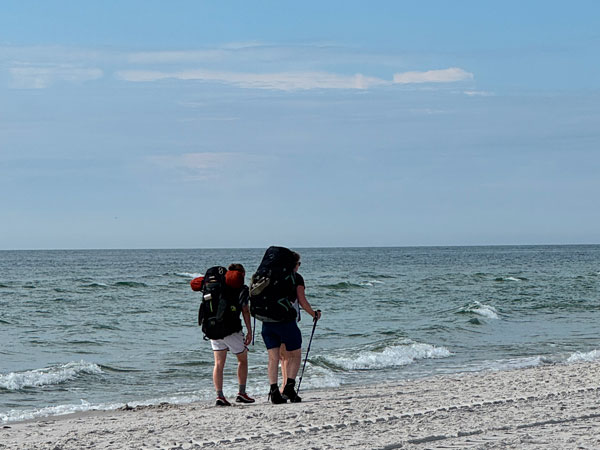
Beach, beach and more beach – wide, white sands of the south coast. From Snogebæk on the main road to Turistvej, where the trail enters Dueodde Beach – the famous beach with Europe's finest sand. Worth a detour to the Dueodde Fyr lighthouse (47 m) and Bornholmertårnet tower – a former Cold War intelligence listening post, now open to visitors. After 6 km of beach, the trail leads between dunes to Slusegård Vandmølle – where the 15th meridian and 55th parallel intersect (marked with a tile in the ground). Then the cosy harbour of Østre Sømark, more beach, and then a section through pine forest and the Raghammer military training area to Boderne.
Stage details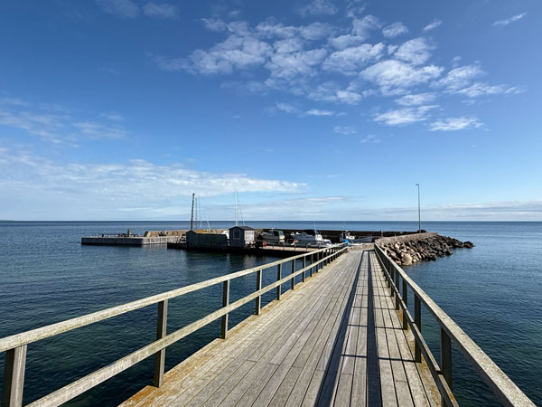
Closing the loop – a stage with character. From Boderne harbour the trail leads along the beach and alternating steep stairs up to the clifftop and back down. Stony beach and steep descents – probably the least-walked section of the entire Kyststien. Before Arnager a short road section, then through forest to the fishing village with Scandinavia's longest wooden pier (200 m). After Arnager the trail skirts the airport, loops through pine forest and the Stampen holiday cottage area. The last 3 km through coastal dunes and plantation to the popular Galløkken beach in Rønne, from where it's a straight walk to the centre and Velkomstcenter.
Stage detailsDifficulty has been rated from the perspective of people with multi-day trekking experience.
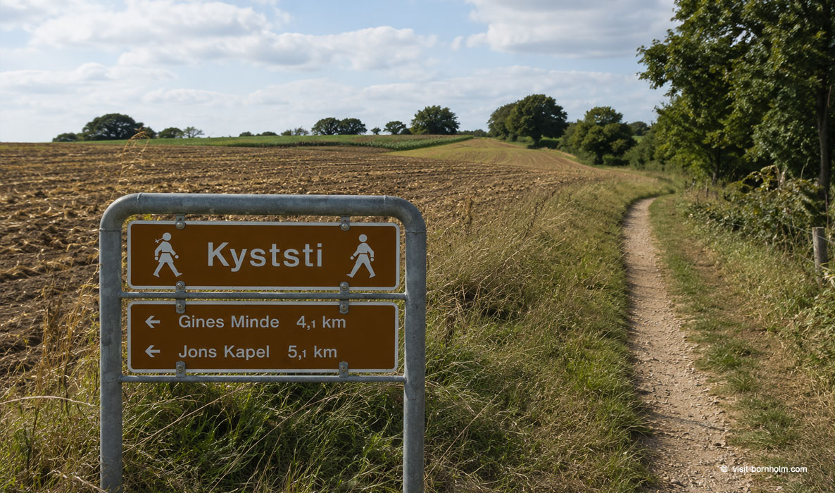 Kyststien waymarking (The Coastal Path)
Planning and practical tips
When to go?
Best period: May–September. Summer has the longest days and 17–22°C. Spring and autumn: fewer crowds, beautiful colours. In winter the trail is accessible but rocky sections can be slippery.
Accommodation on the trail
Campsites, hostels (Danhostel), free shelters and basic camping spots (fri-camps) every 10–20 km. In season (July–August) book ahead.
BAT buses
Local buses connect all towns on the trail. Convenient for reaching the start of a stage or returning to base. Timetables: bat.dk.
Water and toilets
Public toilets with water in every town on the trail. On longer sections (stages 6 and 7) carry extra – gaps between facilities can be long.
Navigation
Offline maps, POIs, accommodation: Mapy.cz or Komoot with offline GPX route.
Supplies
Grocery shops in Rønne, Hasle, Allinge, Gudhjem, Svaneke, Nexø. On stages 6 and 7 (south) options are limited – stock up in Nexø or Snogebæk.
Accommodation on the trail
Along Kyststien there are campsites, hostels, free bivouac shelters and basic camping spots (fri-camps). Distances between accommodation are 10–20 km. In season it's worth booking ahead – especially shelters on the popular northern sections.