Hammerknuden (Hammeren) – the wild promontory of northern Bornholm
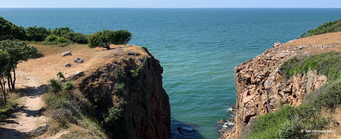
Hammerknuden – commonly known simply as Hammeren – is the northernmost tip of Bornholm. A vast granite promontory covering 182 hectares, with cliffs rising 26 metres above the Baltic, two lighthouses, two lakes, the ruins of a medieval chapel, and a network of hiking trails through heathland, bare rock and stunted scrub. It is one of the wildest and most spectacular places on the entire island.
A landscape shaped by glaciers
Hammeren owes its rugged character to the Ice Age. Advancing glaciers stripped away all sediment, exposing the bare granite bedrock – one of the finest such exposures in Europe. Glacial striations indicating the direction of ice flow are still visible on many rocks. The area is separated from the rest of the island by a rift valley, giving it the feel of a separate, isolated world.
The climate and strong sea winds have ensured that the vegetation of Hammerknuden consists mainly of heathland, dwarf shrubs and low, dense scrub. The absence of tall trees heightens the impression of raw, open space – and on a clear day the Swedish coast is visible from here.
The granite rush of the 19th and 20th centuries
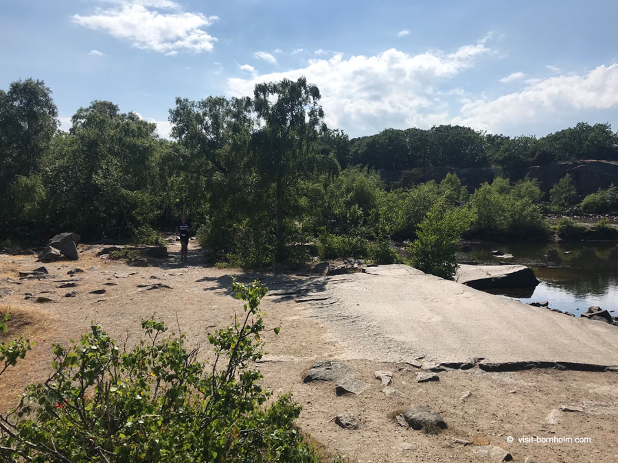
Hammeren is not just wild nature – it is also an area with a rich industrial history. In the 19th and 20th centuries, local granite quarries supplied building material for major projects in Denmark and beyond. The most striking trace of this era is Opalsøen – a deep, emerald-green lake filling a former quarry, connected to the shore by a 290-metre cableway for transporting granite. On the plateau above lies a second quarry lake – Krystalsøen.
The largest lake on Hammerknuden – and on all of Bornholm – is Hammersø. It is the only tarn (glacial rock-basin lake) in Denmark. Surrounded by heathland and rocks, with a view of the Hammershus ruins, it forms one of the most picturesque points on the trail around the promontory.
Two lighthouses
Two lighthouses stand on Hammerknuden – each with its own history and character.
Hammeren Fyr (the Great Lighthouse)
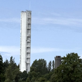
Hammeren Fyr stands on the summit of the 82-metre Ørnebjerget (Eagle Hill) – the highest point of northern Bornholm. A lighthouse has operated at this spot since the Middle Ages, and the current granite tower, built from stone quarried just a few hundred metres away, dates from 1872. Decommissioned in 1990, it has been lit again at night since 2011. It offers outstanding views.
Hammeren Fyr lighthouse – more information
Hammerodde Fyr (the Small Lighthouse)
Hammerodde Fyr stands on the very northern tip of Bornholm. Built in 1895 as an auxiliary lighthouse, it remains operational to this day. The surrounding crew quarters are now private summer cottages. This is the northernmost point of the island – beyond it lies only the sea.
Hammerodde Fyr lighthouse – more information
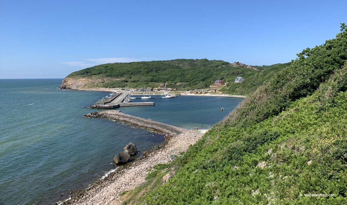 View of Hammerhavn from Hammerknuden
Salomons Kapel – ruins of a fishermen's chapel
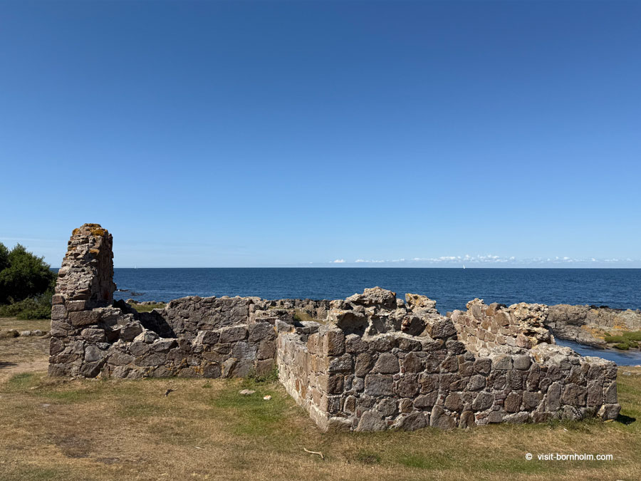
Near Hammeren Fyr, right on the rocky seashore, stand the ruins of Salomons Kapel (Solomon's Chapel). The chapel was built at the beginning of the 14th century from brick and hewn boulders, commissioned by the Archbishop of Lund. It is named after St Solomon, a Dominican friar.
The chapel was erected in two stages – first a small rectangular church, then a porch added to the south. Remains of the altar and brick benches along the walls are still visible. The chapel was linked to Bornholm's herring trade with the Hanseatic cities of Hamburg and Lübeck from the 13th to 15th centuries – fishermen landing in the natural coves along the Hammerknuden coast needed a place of worship.
Hiking trails – the Hammerknuden loop
The entire promontory is criss-crossed by a network of hiking trails connecting Sandvig with the ruins of Hammershus. The most popular route is the Hammerknuden loop – it follows the rocky coast northward to Hammerodde Fyr, then continues along the coastal path (Kyststien) south-east towards Hammerhavn.
Along the way you pass Opalsøen with its former cableway, Hammersø with its panorama of Hammershus, the ruins of Salomons Kapel, and both lighthouses. The trail is of moderate difficulty but requires good footwear – the terrain is rocky and sections of coastline can be steep.
Good to know about Hammerknuden
- The entire Hammerknuden area is a protected nature reserve – stay on the trails and do not remove stones
- Hammersø is Bornholm's largest lake and the only tarn (glacial lake) in Denmark
- On a clear day the Swedish coast is visible from the cliffs
- The terrain is roughly 50% rock, 25% forest and 25% farmland
- The trails can be windy and slippery – bring comfortable shoes and a windproof jacket
Location
| Hammerknuden (Hammeren) | |
| Fyrvej, 3770 Allinge – the northernmost promontory of Bornholm, just beyond Sandvig | |
| Free car park at Hammeren Fyr (Fyrvej) or at Hammershus – trails to the promontory start from both. You can also walk from Sandvig (approx. 2 km) | |
| Navigate: |