Almindingen – The Largest Forest on Bornholm
Almindingen is one of the largest and most beautiful forests in Denmark, located in the very heart of Bornholm. It is an ideal place for those seeking peace, nature, and scenic walking and cycling trails. Vast forest areas, post-glacial lakes, distinctive rock formations, and rich flora and fauna make Almindingen a must-see destination when visiting the island.
History and Character of the Area
For centuries, Almindingen served as common land for the island’s residents – hence its name, which loosely translates to "shared pasture". In the 19th century, the forest underwent extensive reforestation and development, making it today one of the most interesting examples of sustainable forest management in Europe. While walking through Almindingen, you’ll encounter ancient oaks, spruces and beech-lined paths, as well as natural clearings that provide refuge for many species of birds and wildlife, including the well-known mouflons introduced to Bornholm in the 20th century.
Attractions and Activities
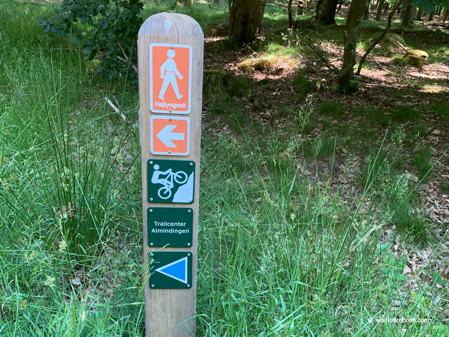
Almindingen offers a wide variety of hiking and cycling trails of different lengths and difficulty levels, making it suitable for families as well as experienced outdoor enthusiasts. One of the highlights is the viewing platform at the Rytterknægten tower – the highest point on Bornholm – which provides panoramic views over the forest and toward the island’s coastline. In the heart of the forest lies the picturesque Ekkodalen valley, famous for its natural "echo", which can be heard when calling toward the steep rock walls. It’s a perfect place for a peaceful walk, picnic or quiet moment in nature.
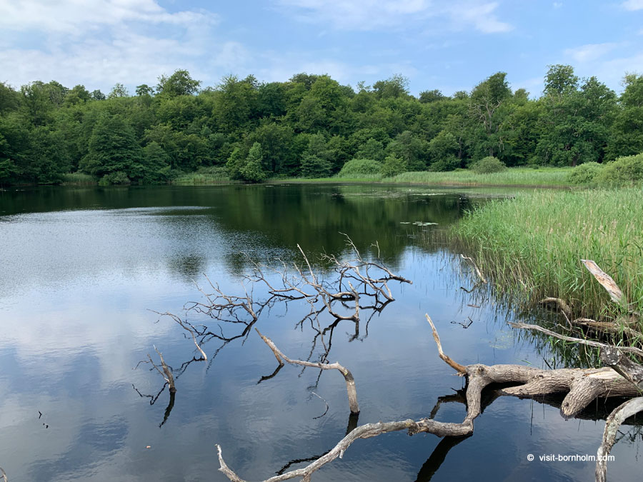
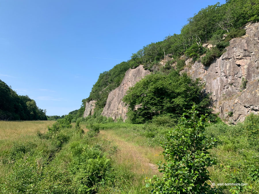
Ekkodalen – The Echo Valley
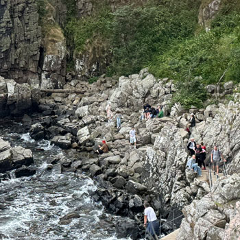
Ekkodalen, meaning "The Echo Valley", is one of the most recognizable landmarks in Almindingen. This long, narrow valley surrounded by steep rock faces is known for its unique acoustics – simply call out toward the cliffs and your voice will echo back clearly. It’s a scenic and tranquil area ideal for leisurely walks or a picnic in natural surroundings. While strolling through the valley, you can admire lush vegetation, small streams and characteristic rock formations that give Ekkodalen a distinctive, almost magical atmosphere.
Ekkodalen stretches for about 1 km, and the surrounding rock walls rise up to 20 meters in height. Just by the entrance to the valley, approximately 20 meters from the trail, lies the well-known Hans Christian Ørsted spring – one of the most iconic spots in this part of Almindingen.
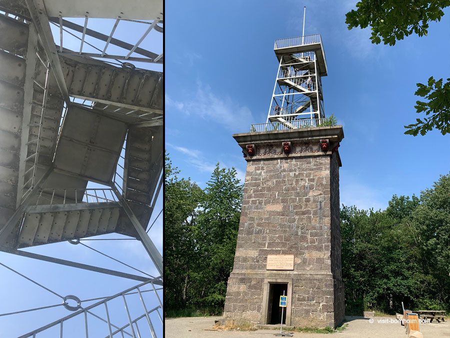
Rytterknægten – The Highest Point on Bornholm
Rytterknægten is the highest point on Bornholm, rising to 162 meters above sea level. At its summit stands a distinctive observation tower constructed in the 19th century to commemorate the visit of King Frederik VII. The tower was later extended with a steel structure, allowing visitors to enjoy views above the treetops of Almindingen. The Rytterknægten tower is open year-round and free to visit, making it one of the most frequently visited locations in central Bornholm.
The area is accessible via numerous well-marked walking and cycling trails, making it suitable for both families and more experienced hikers. Around the tower you’ll find open meadows, resting areas and information boards providing insights into the history and natural environment of Almindingen.
Rytterknægten is not only a viewpoint but also a wonderful place to relax and immerse yourself in nature. From the top, you can enjoy extensive views across Bornholm’s forests and, on a clear day, even glimpse the island’s distant coastline. It’s an essential stop for anyone who wants to appreciate the scale and wild beauty of Bornholm’s largest forest.
European Bison in Almindingen
Almindingen is also home to a herd of European bison, introduced to Bornholm in 2012 as part of a conservation program. The animals live in a large fenced area in the central part of the forest, and can be observed safely from designated viewing spots. Although sightings depend on time of day and the animals’ natural movements, just being in their presence offers a memorable experience. Their majestic appearance enhances the wild character of Almindingen and makes it a notable attraction for nature lovers visiting the island.
Old Castles – Lilleborg and Gamleborg
In the center of Almindingen you’ll find the remains of two medieval strongholds: Lilleborg and Gamleborg. Both played important roles in Bornholm’s history, but each represents a different era and style of fortification. Today, their ruins stand as quiet witnesses to past struggles for power over the island, and walking among them feels like a journey back in time to the age of kings, bishops and stone fortresses.
Gamleborg is the older of the two, built around the 10th–11th centuries, and served as the largest fortified settlement on Bornholm during the Viking Age. Surrounded by natural hills and massive stone walls, it commanded strategic control over central areas of the island. Although now in ruins, its size remains impressive and hints at its former importance. Over time, Gamleborg lost its strategic relevance as new centers of power emerged.
Lilleborg, located near the scenic lake Borresø, was constructed in the 12th century as a fortress of the bishops of Lund. With more advanced defensive design, it became an influential political seat on the island. Today, only its stone foundations and wall fragments remain, but its dramatic hilltop location offers beautiful views of Almindingen and creates an atmospheric, almost timeless setting. The walk between Gamleborg and Lilleborg is not only historically fascinating but also a pleasant route through the serene forest landscape.
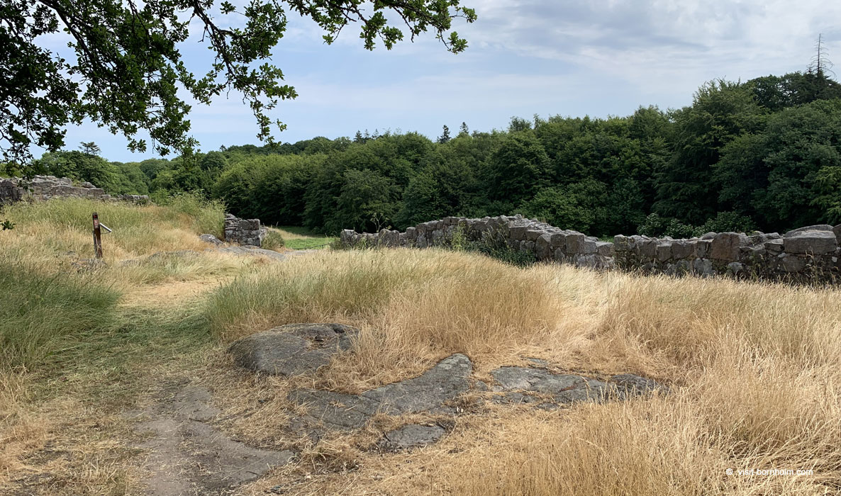 Lilleborg Ruins
Good to Know About Almindingen
- Almindingen covers more than 2,400 hectares, making it one of the largest forests in Denmark
- The forest features dedicated horseback riding trails and paddocks, making it a popular place for equestrian activities
- There are several forest shelters available for overnight stays, allowing visitors to sleep outdoors according to local outdoor access rules
Location
| Almindingen | |
| Located between Rønne, Åkirkeby and Gudhjem | |
| There are several free parking areas located near key entry points to the forest, including near Rytterknægten, Ekkodalen and along trails leading to Lilleborg and Gamleborg |